| |
|
|
 |
|
Frequently Asked Questions |
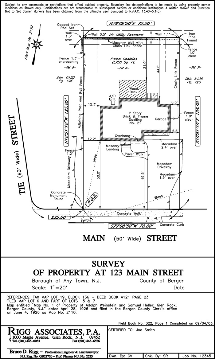
What is a Land Survey?*
A land survey is the measurement along points, lines and physical features on or near the surface of the earth to determine, describe and record distances, elevations, directions, angles and other features that precisely locate property and all structural improvements to property.
What are the requirements to be a Professional Land Surveyor?*
Under New Jersey Law to be licensed as a surveyor an individual must complete a four year course of higher education in surveying, including mathematics and science studies, in a state-approved curriculum; must have three years practical experience; and must pass a 16 hour written examination conducted by the State Board of Professional Engineers and Land Surveyors.
Why are Land Surveys so important?*
Land surveys are the only scientifically precise assurance for the identification and marking of property boundaries and characteristics. Therefore land surveys are the best and most appropriate means by which property buyers/owners can establish full, clear legal claims to the homes and businesses they purchase, maintain or sell.
How do I know which Surveyor I should hire to perform my property survey?*
A land surveyor must be licensed by the state and should be able to answer most questions you may have regarding your property and its boundaries. Since locating boundaries may vary from area to area it is important that the surveyor be familiar with the area he/she is working in. Rigg Associates currently has three licensed land surveyors performing and/or overseeing land surveys.
*(as described by the New Jersey Society of Professional Land Surveyors)
|
|
|
|